Peru - 1983

Rebels

Not as big a thing as the papers seemed to indicate. The 'attack' on Cusco just before I left was during a conference on economic alternatives for Peru and there was one more alternative that the rebels wanted to remind them about. However, the organizers did consider rerouting part of our trip to put us a little farther away from a rebel stronghold.

Trip Members

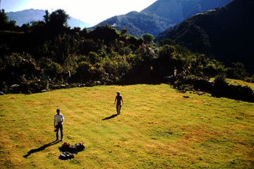
There were only 3 people signed up for this trip and they ran it anyway. One of the 3 became ill at the last minute and didn't make it at all, so there were only 2 paying customers on the trip. We had 1 guide, 3 cooks (or camp staff), 3 wranglers to take care of 13 horses and mules and at one point where we couldn't take the animals, we had 8 porters.

Health

I had no health problems the entire trip, just the usual cuts, scrapes and bumps that you expect when camping and hiking.

Difficulty of Trip

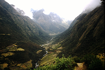
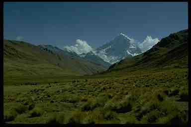
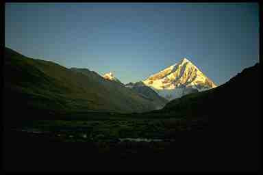
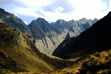
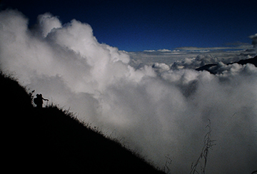
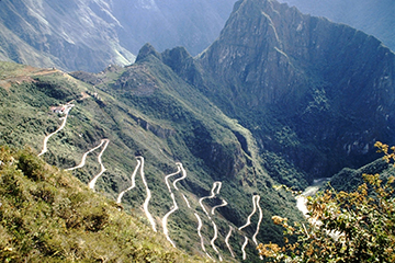
The trip was rated as difficult. This was because of its duration (23 days on the trail) and the elevation gains and loses that we went through. One day, we gained 6500 feet and then lost 3000 feet. The trip was easier because we were all fast hikers. You expect the guide to be strong. The other fellow along ran marathons. His fastest was one he ran 2 weeks before the trip which he ran in 2 hours, 34 minutes (very fast since the world record is about 2 hours, 8 minutes). Before that he used to do 'fell running' which is racing up and down mountains.
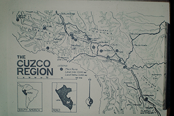
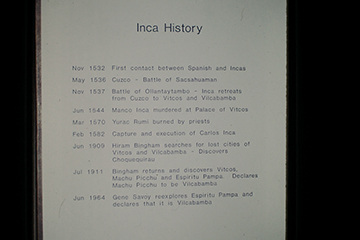
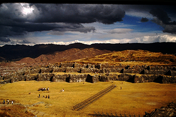
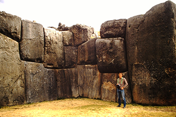
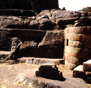
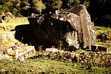
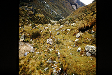
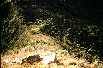
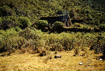
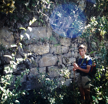
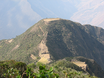
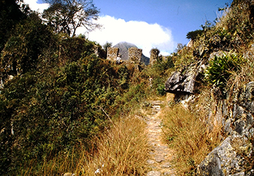
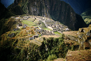
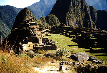
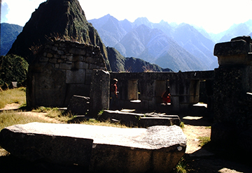
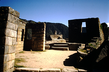
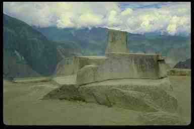
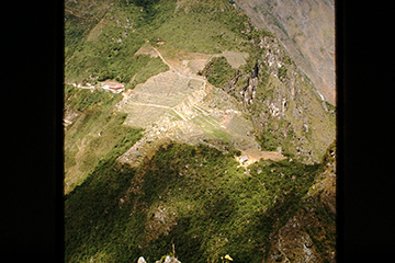
Inca Ruins

We saw some amazing ruins that few people ever see because of the difficulty of getting to them. I was very concerned about the state of these ruins, however. Some had almost been reclaimed by the jungle. For as important as some of these ruins are, their state was very disappointing.

Problems

Virtually none. One of the smoothest run trips I've been on.

Unusual Things

One day we saw a farmer burn off the hillside that we had just walked down. They burn off the dry grass that the animals won't eat so that the grass sprouts new green shoots which they do eat. We also saw a horse fall off the trail over a 50 foot cliff and walk away.

Map of South America, Peru and the Cuzco region.
Timeline of the conquest of the Incas and of the rediscovery of Macchu Picchu.
Overlooking the city of Cuzco from Sacsayhuaman
Long view of the fortress of Sacsayhuaman with the 3 levels of walls.
Some of the stones in the lowest level wall of Sacsayhuaman.
Damaged Intihuytana above the city of Pisac. Damaged by the Spanish during the conquest because they knew the significance of this to the Inca people.
Yurac Rumi - White Rock - a site which helped Hyram Bingham to identify Vitcos.
The remains of Vitcos, the city the Inca retreated to when Cuzco was taken over by the Spanish.
Whew. About a week after we were at this spot our leader told us about it. He said he and the camp staff breathed a sign of relief when we got here. This took us totally out of rebel (Shining Path) territory. I'm just as glad they waited to tell us.
Remains of an Inca road we hiked on.
Enroute to Choquequirao. We have to drop down this side of the valley and up the other side the next. We'll go over about there the tiny cloud is casting a shadow.
Choquequirao. There's not much to see here. but Byram Bingham visited here in trying to locate Vilcabamba.
Choquequirao from the point of land above the river.
The few remaining buildings.
Dave by a terrace wall as we were leaving.
Choquequirao as it's been discovered since we were there.
On our way back from Choquequirao. The black area was a field burned off by the owner just after we passed through.
Salcantay on arriving a camp.
Salcantay the next morning.
The Inca Trail enroute to Macchu Picchu.
The ruins of Phuyupatamarca - City in the clouds.
On the Inca Trail to Machu Picchu. This is one of my favorite slides. We had stopped to take a picture of the ruins behind us but the clouds just wouldn't life. We turned around to head up the trail, I looked up, whipped out my camera and took this picture.
Intipunku - the gateway to the sun the entrance to Macchu Picchu.
Macchu Picchu with the Urubama river and the road from the train station to the ruins.
Machu Picchu looking toward Huyna Picchu. This is a pretty traditional view of this once lost city.
An area known as the parade ground.
Temple of 3 Windows - the first thing Hyram Bingham discovered. When he saw this he knew he as on to something big.
An Intihuytana is in the center.
Close up of the Intihuytana. This symbol was known to the Incas as the hitching post to the sky. It had great significance to them. It is undamaged unlike the one above Pisac. This suggests the Spanish were never at Macchu Picchu.
Machu Picchu from Huyna Picchu. The Intipunko (gateway to the sun) is on the left, the trail from it to Machu Picchu, and on the lower right is Machu Picchu.
Back to Chronological List of Trips
Back to Home Page