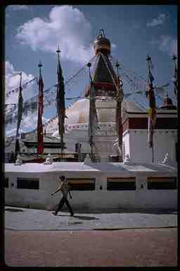
Bodhnath is a Buddhist temple in Katmandu. It is one of the largest in the world.
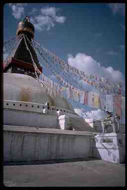
Buddhist prayer flags flying at Bodhnath. The flags have prayers printed on them. As the flags flap in the wind, the prayers are sent to heaven.
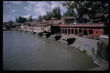
Pashupatinath, a Hindu temple in Katmandu. The platforms extending into the river are cremation sites.
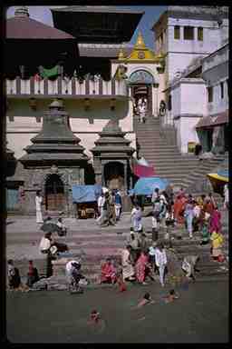
More Pashupatinath
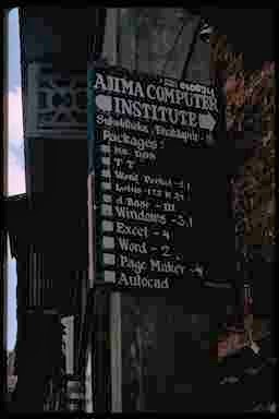
Software in Nepal. Even in 1996 when this was taken, some of the version numbers of the advertised software are pretty out of date. Of course it could be that it's just the sign that's out of date.
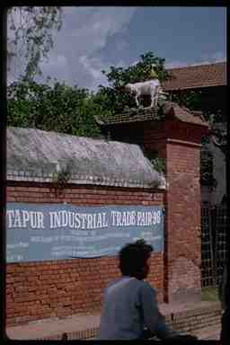
Note the goat on top of the wall.
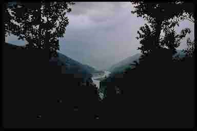
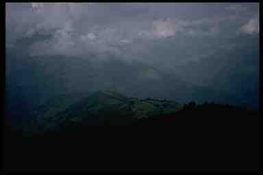
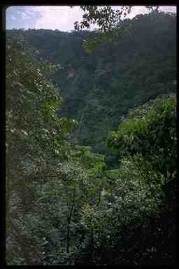
Looking down the Arun River valley. This is the way we came back from Makalu. It really started raining hard not too long after this was taken. No surprise given those low lying clouds.
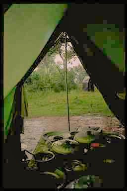
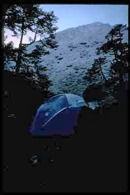
Rain and Dinner. This is looking out of the dining tent after dinner. All the dishes on the table should give you some idea of how well we ate. The small tent seen through the dining tent door to the right is the bathroom. The standing water on the ground is a sign of how hard it rained.
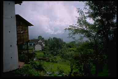
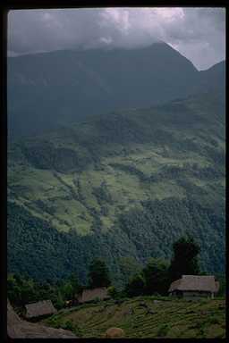
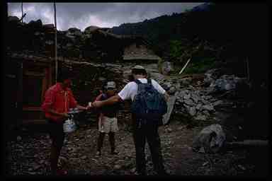
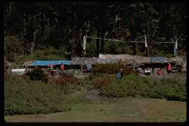
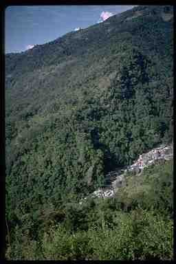
Homes. We were at a low altitude, around 2000 feet or so. It was a very lush and prosperous region.
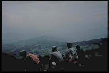
Taking a break on the trail and looking toward the Arun valley. The sweat patterns on peoples backs give you an idea that it's hot down here.
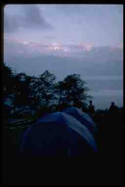
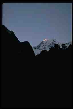
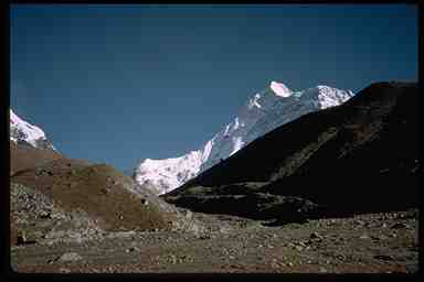
With wet tents in the foreground, you can see the Himilayas just peaking above the clouds. This was the best view we got all day.
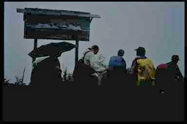
"You are here." The sign board shows the Himilayan peaks you can see from here. They'd also be in the picture if the rain wasn't in the way.
We headed down the ridge to the village of Nun. The next day we'll head down the ridge to the left and cross the Arun River. The river did an arc to the west between where we started and here. We just hiked across the chord of the arc.
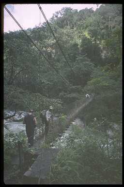
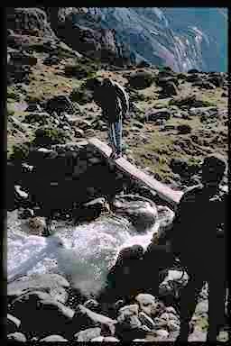
It was nice to have a good solid bridge to cross the river. It was also very hot and humid. We took a break on the other side of the bridge and I think I managed to wring out about a quart of sweat from my t-shirt.
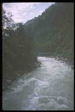
Looking upstream, up the Arun River.
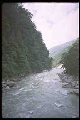
Looking downstream
Looking up. As we head up the other side of the valley, this looks at the side we just came down.
And up.
Nun is just barely visible on the opposite side of the valley along the near ridge. But you can't see down to the river from here. This may have been one of the shortest days in terms of distance, campsite to campsite. But it was sure a tough day.
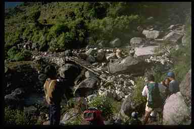
Tough way to go. In the center you see a broken down bridge which most of us didn't use. We went around the rocks to the right. In the lower right Ralph is getting a hand up one of the difficult spots in the trail.
Welcome to camp. We knew when we got to the end of the hiking for the day. There would be a Sherpa with a cup of hot fruit drink waiting for us.
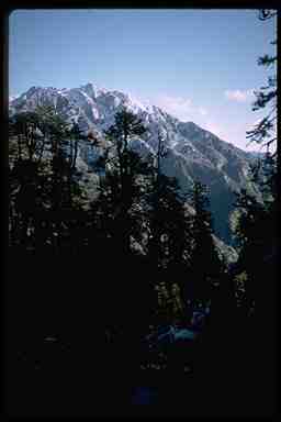
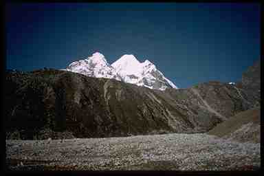
Kanchenjunga. Along the skyline you can just make out Kanchenjunga, the fourth highest peak in the world.
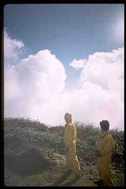
Rainsuits. Our porters were issued yellow rainsuits when they were hired. Guess what those clouds did to us later in the day.
The passes. This is taken from the Shipton La, the first pass of the day. Just under the clouds is the second pass for the day. The bright spec in the lower left is a porter in his rainsuit.
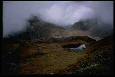
Snow. We got snowed on overnight. The tent still has a little snow/frost on it. Most of the opposite hillside is fresh snow.
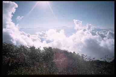
And sun light. However having a bright sunny day after the snow is nice. If we could only get off the north side of this hill so we could get in the sunlight.
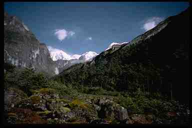
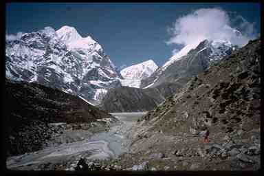
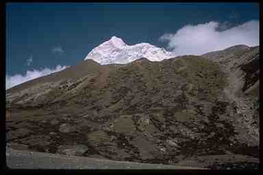
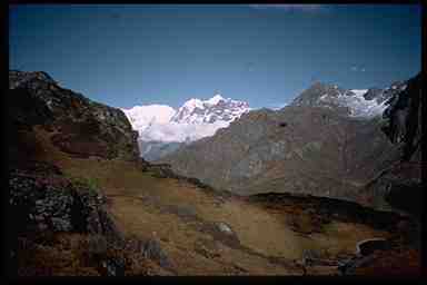
Makalu. The white peak in the center is Makalu. Given all the rain and cloudy days, this was really our first good view of it.
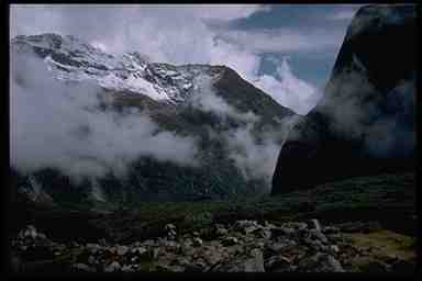
More rain. However after that good view of Makalu, the weather closed in again. The pattern became for clear and sunny in the morning with clouds moving up the valley becoming overcast by mid afternoon. The bridge is crossing a branch of the Barun River. We'll be following this river most of the way to Base Camp.
Dawn on Makalu. Since the sun hasn't hit us yet, it's really cold. We started hiking earlier than usual to warm up and to get into the sunlight sooner.
Up the valley.
Clouds rolling in.
Morning start. While that little log across the stream looks easy to cross, it wasn't. It was a little slick with early morning frost. Also the stream was load and moving fast. No one wanted to slip and fall into it to start the day.
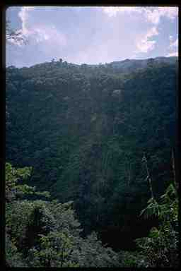
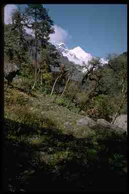
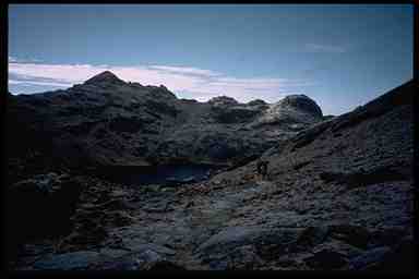
Scenery. Mostly unnamed peaks on our way to Makalu.
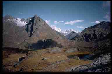
More scenery. Progressing toward ourhigh camp.
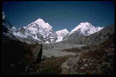
Panaroma 1. The next series forms a panaroma from the area of our high camp.
Panaroma 2
Panaroma 3. Makalu itself.
Panaroma 4
Panaroma 5
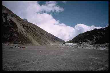
On the way. Off and heading for 16,000 feet and the Makalu base camp.
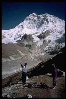
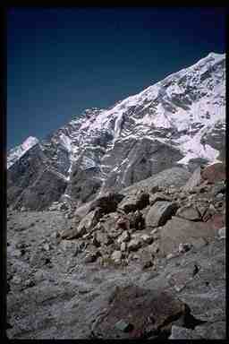
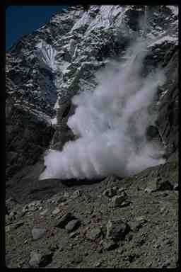
Pointers - Makalu. Pasang is pointing to a small avalanche on the opposite hillside.
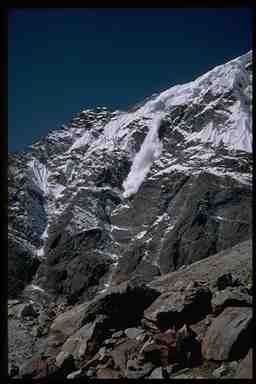
Avalanche 1. Avalanches sound like thunder. We were never in any danger. None of the trails we were on were anywhere near such snow fields.
Avalanche 2
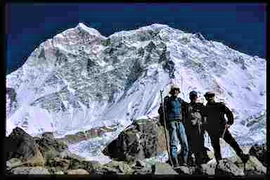
We're there. The high point of the trip (literally).

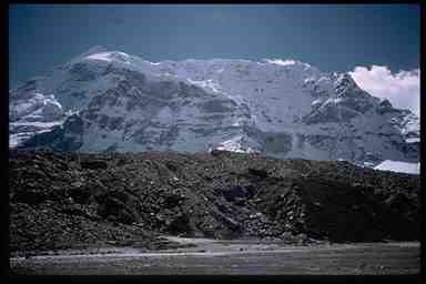
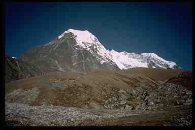
Makalu. One final full view of the peak.
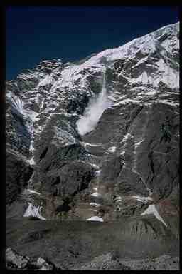
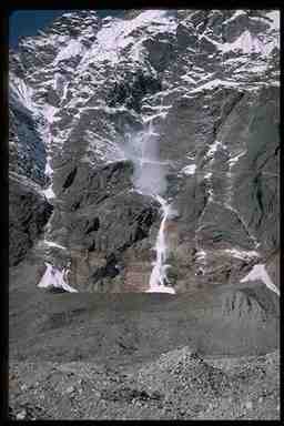
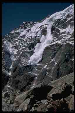
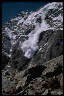
Avalanche 1 - Another, much bigger avalanche.
Avalanche 2
Avalanche 3
Avalanche 4
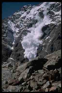
Avalanche 5
Avalanche 6
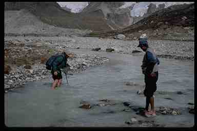
River crossing. This was a painful crossing. For one thing the water is coming right off those snow fields just visible in the background. However the stones and rocks hurt more than the cold. I didn't get cut, but it sure hurt.
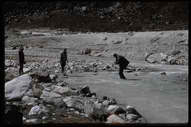
Plan B. However just charging in with boots, socks and pants as normal certainly makes for a faster crossing. Of course drying out takes longer.
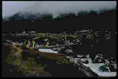
Civilization. We camped in the field by this little store. This is just occupied in the summer. They lady who runs it returns over the passes to town for the winter.
An early morning start for a long day. Mostly downhill, but still a long day. The trail is still a little icy from the snow and rain the previous day.
Last look at Makalu.
The passes again. On heading in, this was almost totally covered by clouds.
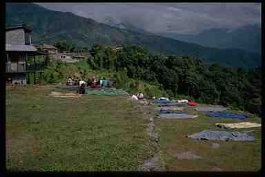
Drying day. We finally got to a place where the location and the sun cooperated and we were able to lay almost everything out to dry.
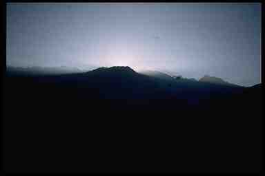
Dawn. The sun rising behind a hill.
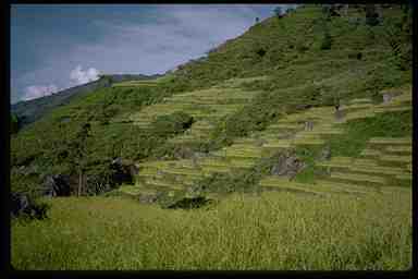
Rice fields. We're back down to lower altitudes where crops such as rice can be grown. And we have to start paying attention to leaches again.
Long drop. Although we were just following the Arun river around, there were many valley crossings which involved steep downs and ups. You can just make out the suspension bridge across the river.
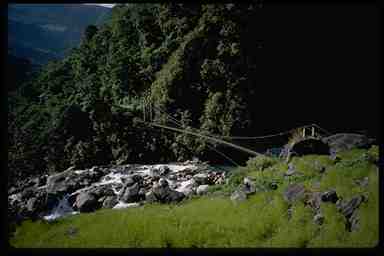
The bridge. It was really a good bridge. Much bigger than you might expect from the previous picture.
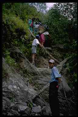
Ladder. The ladder the porters are on is just a big log with notches cut in it for steps.
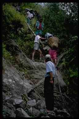
Ladder 2. I'm glad I just had to deal with this while carrying a day pack. I'd hate to try it carrying a full load like these porters.
Back to Chronological List of Trips
Back to Home